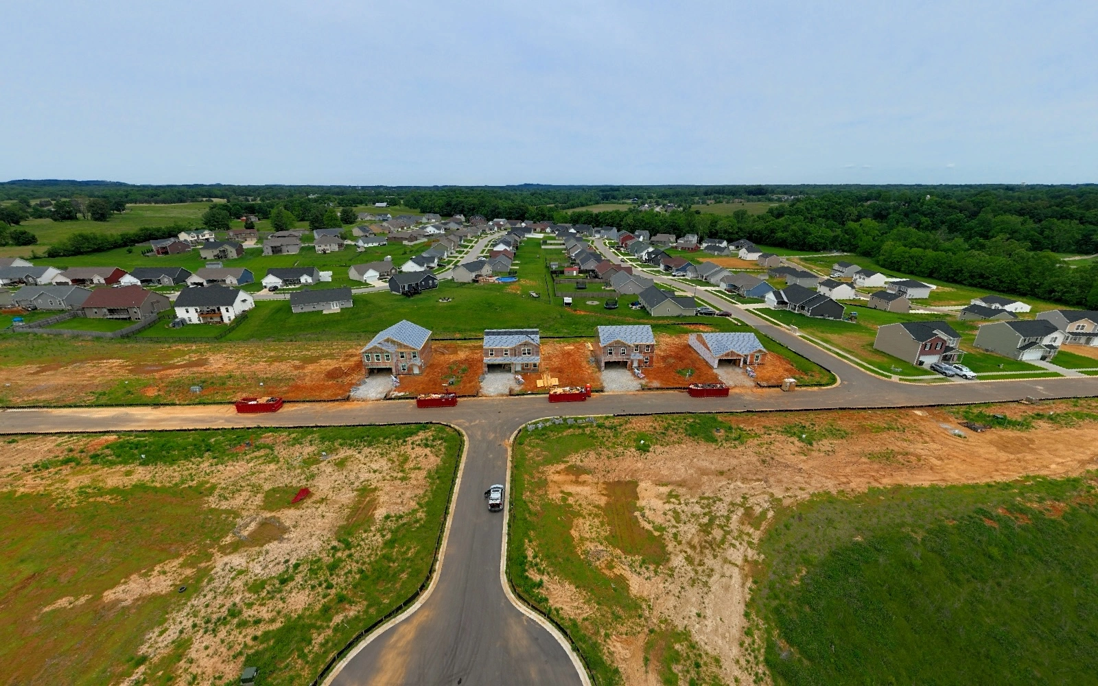
Construction Progress Monitoring
Dated, repeatable aerial documentation of your job site — the same positions every visit, RTK/PPK-georeferenced, with a report your owner and lender can read.
A job site changes every day, and the people paying for it usually aren’t standing on it. Recurring drone documentation keeps owners, lenders and project teams looking at the same current picture, and builds a dated visual record that answers a schedule question with a dated picture instead of a memory.
We fly the same positions on every visit. RTK/PPK-georeferenced on every flight, so month six overlays month one pixel for pixel. Overviews, orbits and detail shots are delivered as an organized package you can drop straight into an owner report or draw request.
When the project wraps, the same archive becomes marketing: a groundbreaking-to-completion story told from the air.
How it’s flown
DJI Mavic 3 Enterprise with RTK module, with an Emlid Reach RS2+ base station set up on site for every visit. The aircraft flies the same waypoints every visit, so the oblique set, the orbit and the mapping grid repeat visit after visit. Airspace authorization is handled before arrival.
Two tiers, per visit
Site Record — from $295. Oblique stills from fixed positions, orbit video, 360° panorama, dated same-frame comparison pairs, and a dated 1-page report. No mapping grid.
Site Record + Map — from $495. Everything in Site Record plus a mapping grid flown RTK/PPK, delivered as an orthomosaic and 3D model.
Maps and models are drone-photogrammetry products for progress documentation and visualization. They represent generalized locations of features and are not a boundary or land survey; survey work is referred to licensed Kentucky surveyors.
Cadence that matches the job
Per-milestone — a flight at each major milestone: sitework, foundation, framing or steel, dry-in, and completion. The lightest option, and enough to keep an owner report current. Single milestone flight: from $350.
Biweekly — a flight every two weeks, on a monthly plan: Site Record from $550/month; Site Record + Map from $900/month. Month-to-month, no minimum term. The usual choice for a project on a normal schedule, and the one that makes side-by-side comparisons genuinely useful.
Weekly — a flight every week, for fast-moving phases or any project where the schedule is being tracked closely. Site Record from $275 per visit.
Final quote depends on site size, airspace and deliverables — most quotes go out the same day.
What a monthly program looks like
On one residential development we made 15 visits over 19 months (October 2023 to May 2025), from early sitework through the first homes going vertical: one mapping grid and one 360° panorama per visit, flown from the same positions each time, so any two dates line up frame for frame. That archive is what a schedule question, a draw request, or a closeout package gets answered with.
What a weekly series looks like
On a Louisville-area residential development, weekly since August 2026 we flew seven consecutive weekly visits, August 4 to September 16 — the same mapping grid, oblique set, orbit video and 360° panorama each week, flown from the same positions every visit. See how a report reads: View a sample progress report.
Talk it through first
Not sure which cadence fits? Book a 15-minute site call and we’ll look at your schedule together — no quote required to have the conversation.
Interactive deliverable
Look around the jobsite. Then move through time.
Four repeat 360° captures from the same position reveal construction progress in every direction—not just where a single camera happens to point.
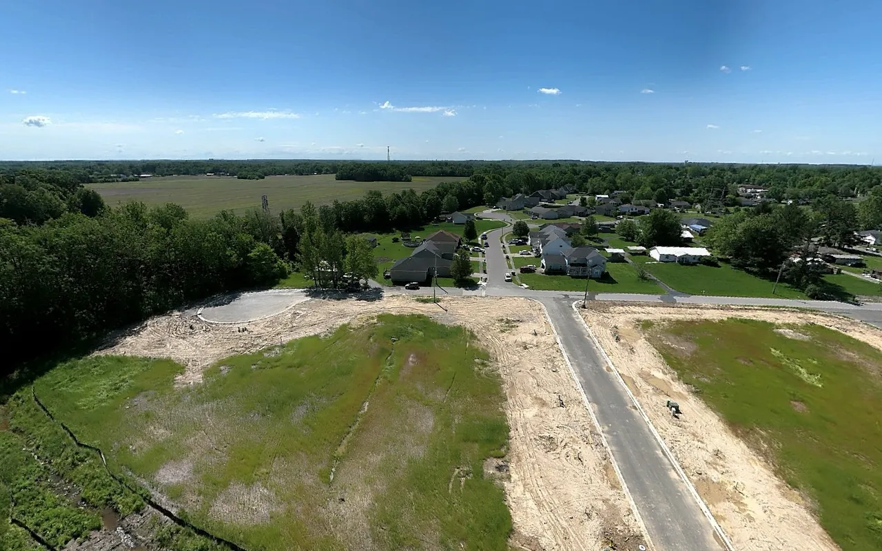
4K panorama · drag to look around · scroll or pinch to zoom
Common questions
How often should we fly?
Most projects do well with biweekly or monthly flights, with weekly coverage during fast-moving phases like steel erection or sitework. We'll match the cadence to your schedule and budget.
Can you document disputes or delays?
Time-stamped aerial documentation is one of the best records you can have for schedule disputes, differing site conditions, or insurance claims. Consistent recurring capture gives everyone the same dated record to look at.
Do you coordinate with site safety?
Yes. We check in per your site protocol, fly outside of crane radii and active lift zones, and carry FAA Part 107 certification with airspace authorization handled before we arrive.
Are you insured?
Yes — $1 million aircraft and commercial general aviation liability, underwritten by Global Aerospace, worldwide territory. Where your contract requires it, the certificate names your company as additional insured, and the coverage is primary and non-contributory with a waiver of subrogation. A certificate of insurance is available on request. Send us your insurance requirements before the first flight and we will confirm in writing that we meet them.
Can I see a sample progress report before we start?
Yes. View a sample progress report, or ask and we will walk you through one on a 15-minute call.